LiDAR online

At SWAG we have a strong interest in all things LiDAR. If you feel the same way then you’ll want to take a look at the Open Data Maps website: http://enfarchsoc.org/opendata/
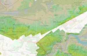
open maps data

Details about the site

  • OpenStreetMap is built by a community of mappers that contribute and maintain data about roads, trails, cafés, railway stations, and much more, all over the world
  • OpenStreetMap emphasizes local knowledge. Contributors use aerial imagery, GPS devices, and low-tech field maps to verify that OSM is accurate and up to date
  • OpenStreetMap’s community is diverse, passionate, and growing every day. Our contributors include enthusiast mappers, GIS professionals, engineers running the OSM servers, humanitarians mapping disaster-affected areas, and many more. To learn more about the community, see the user diaries, community blogs, and the OSM Foundation website
  • OpenStreetMap is open data: you are free to use it for any purpose as long as you credit OpenStreetMap and its contributors. If you alter or build upon the data in certain ways, you may distribute the result only under the same licence. See the Copyright and License page for details
  • Hosting is supported by the UCL VR Centre, Imperial College London and Bytemark Hosting, and other partners
Posted in News & Events | Tagged , | Leave a comment

YAC dig this Sunday

Young Archaeologists Club dig

Shorne Woods Country Park this Sunday (13th March 2016).

Session starts at 10am and goes through until 12:30.

Posted in News & Events | Tagged , , | Leave a comment

Isle of Thanet Archaeological Society’s 2016 Lecture Programme

IOTAS Archaeological Studies Lecture Course 2016

  • 14 Mar 2016: ‘Not Angles but Angels’: St Augustine and the ‘conversion’ of Kent
  • 04 Apr 2016: Rings and Roundabouts:  The Lord of the Manor Ceremonial Landscape – a history and analysis of the excavations
  • 09 May 2016: Before the Flood: The Archaeology of the Palaeolithic, Mesolithic and the lost North Sea Lands.
  • 13 June 2016: ‘The Heathen of the Seas’: Vikings in Thanet?
  • 11 July 2016: Saxon Shores – environmental changes and historical arrivals: an overview of the SE coastline from late Roman to late Medieval times
  • 12 Sept 2016: Richborough Roman Fort – The Gateway to Roman Britain?
  • 10 Oct 2016: Beowulf – fact or fantasy?
  • 14 Nov 2016: Skyscapes and Landscapes: A new interpretation of Stonehenge

Continue reading →

Posted in News & Events | Tagged , , , , , , | Leave a comment

Conservation workshop handouts

A conservation workshop was held on Saturday the 30th January by Dana Goodburn of CSI.  The session was funded by a generous grant from the Kent Archaeological Society. The worskshop gave an introduction to the practical conservation of archaeological finds, on-site best practice, lifting, cleaning, packaging and mounting of finds.

Handouts from the day can be found on the website of the South East Museum. They cover conservation assessment, silica gel and mounting.

Thanks Dana.

Posted in News & Events | Tagged , | Leave a comment

Lower Thames Crossing proposal

Highways England’s have launched a public consultation on the proposed lower Thames tunnel crossing at Gravesend in Kent. This proposal directly impacts on the Shorne area and those of you interested in the park and surroundings may want to have a say on the proposal.

  • For more information on the proposal and a link to the survey click here.
  • To go straight to the survey click here

The consultation is taking place between 26 January and 24 March 2016.

Posted in News & Events | Tagged | Leave a comment