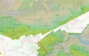
At SWAG we have a strong interest in all things LiDAR. If you feel the same way then you’ll want to take a look at the Open Data Maps website: http://enfarchsoc.org/opendata/
Details about the site
- OpenStreetMap is built by a community of mappers that contribute and maintain data about roads, trails, cafés, railway stations, and much more, all over the world
- OpenStreetMap emphasizes local knowledge. Contributors use aerial imagery, GPS devices, and low-tech field maps to verify that OSM is accurate and up to date
- OpenStreetMap’s community is diverse, passionate, and growing every day. Our contributors include enthusiast mappers, GIS professionals, engineers running the OSM servers, humanitarians mapping disaster-affected areas, and many more. To learn more about the community, see the user diaries, community blogs, and the OSM Foundation website
- OpenStreetMap is open data: you are free to use it for any purpose as long as you credit OpenStreetMap and its contributors. If you alter or build upon the data in certain ways, you may distribute the result only under the same licence. See the Copyright and License page for details
- Hosting is supported by the UCL VR Centre, Imperial College London and Bytemark Hosting, and other partners