Introduction
This Research Note is a sketch of the early history of the Cobham Hall manor and its lords. It draws upon a variety of primary and secondary sources as well as Alan Ward’s 2008 excavation report. A more detailed study needs to be made of Cobham Hall. In addition to the Cobham documents at Medway Archives, lengthy access will be needed to the Hatfield House archives and the Capper-Brooke collection at the Norfolk archive office. More extensive excavation must be permitted at Cobham Hall and internal examination must be made of the “1520s” buildings.
For the purposes of this Note, a manor was a land holding which possessed administrative powers over its tenants and which could require them to attend its courts. Once the feudal system of the Normans had been established, only the king could own land, but he could subinfeudate to his tenants-in-chief and they in turn to others. Any tenant owed service and payment to his lord. All land had to be within one manor or other, but not all the lands of a manor were necessarily in one contiguous block. The feudal system was ended in 1660, but technically manors could continue until finally abolished by legislation in 1922. Settlements, houses and estates which were not manors themselves often existed within manors.
There were once five manors in Cobham parish. Besides the well known Cobham Hall there were Cobhambury, Henhurst, Viaundes and North Court. There was also a sixth estate, Haydon or Hoden Fee, which is thought to have been part of the manor of Frindsbury. This Note deals only with Cobham Hall until its major rebuilding in the later 16th century. Its history from then on is well known and is not repeated here.
The Manor of Cobham Hall
Cobham Hall was a manor in itself, as Sir Thomas Brook explained in his will in 1529: “my mannor of Cobham otherwyse called Cobham Hall” 1; and James Duke of Richmond & Lenox wrote in a release of 1650: “all that the Mannour of Cobham als Cobhamhall” 2. The visual dominance of the present building might suggest that Cobham Hall was the most senior, or at least the oldest manor. However this may not be so. The building we see now was mostly built in the 16th to 18th centuries. Little of its earlier history was understood before recent excavations in the east courtyard. The Cobba hammes mearce mentioned in the Meopham charter of 9393 is more likely to have related to Cobhambury manor, whose house lies just east of the village, but whose lands extended west to the boundary with Meopham. In the Rochester Bridge charter of c.975, Henhurst manor is listed, but Cobham (and Shorne) are not4. Furthermore Henhurst is the only one of the Cobham parish manors to appear in Domesday. Either the Cobham Hall manor did not exist in late Saxon times or it was part of some other estate.
Certainly the church of Cobham existed by c.1080. Along with the church of Shorne, it is assessed at 9 pence in the list of Rochester Priory chrism rents in the Textus Roffensis5: “Cobbeha’.ix.den’. Scorene.ix.den’.” the usual amount due for a church. Then in 1132, Henry I gave to the Priory of Bermondsey “the advowson of the church of Schorn with that of the church of Cobham which is annexed to it”6 which had previously belonged to Turstan his chaplain. This phrase rather suggests that Cobham was some sort of pioneer settlement, linked to an existing manor of Shorne. What would become the Cobham Hall manor was still part of Shorne as far as the Exchequer clerks were concerned thirty years later though that was not the principal Shorne manor and Cobham was not even named on the Pipe Rolls. The Roll for 1165 showed one William de Quattuor Maris paying rent to king Henry II for a manor in Shorne. In earlier years this been part of a much larger estate covering both Hoo and Shorne which had been assigned to the younger brother of Henry I – “William FitzEmpress”. This estate had been amongst the lands recovered by the Crown from Bishop Odo of Bayeaux after the latter’s arrest in 1082 and exile in 1088. Prince William had held the estate since 1157 but he died in 11647.
The next year, William de Quatremere, to use the later spelling, was granted the manor as a tenant-in-chief of the king, as a reward for his military service in Normandy8. He was in due course succeeded by Godfrey, Richard, William (nephew of Richard) and finally Adam de Quatremere (brother of William) who died in 1243. But by 1196 the Pipe Roll shows that this manor comprised land in Cobham as well as Shorne and that it was held by military service of a ¼ knight’s fee and payment of £9 per annum, later £10, to the king. The family of Mauregard inherited the tenancy-in-chief from Adam de Quatremere and in the 15th century it was granted to Eton College, where we lose sight of the “Quatremere fee”.
The Quatremeres came from Leicestershire and we do not know if any of them ever lived at Shorne or Cobham, though presumably a house of some sort was there for whoever farmed the land. After the younger William de Quatremere inherited the manor in 1202, he subinfeudated (rented) it to a tenant, Henry de Cobham9. Henry became a successful county administrator, serving as sheriff, justice and sub-lieutenant of Dover Castle10. We may assume it was he who built the Cobham manor house which existed at his death. By 1208 Henry had acquired additional lands in Cobham, Shorne and elsewhere, as can be seen from King John’s charter confirming his holdings11. Henry’s Cobham lands included not only his Quatremere tenancy, but also lands he had purchased from William and Nicholas, the sons of Wulvord of Fugelstan. Wulvord may have been the Wolwardus who gave the Cobham tithes to the church of Rochester in King Richard’s time.11a Henry had also purchased “the wood in Cobham called Billeberwe” from William of Hehsted.
What would become the Cobham Hall manor included a capital messuage by c.123912 when a family redistribution of Henry de Cobham’s lands after his death gave his son John de Cobham “the Elder” the Quatremere tenancy and “all the land which belonged to Serlo de Cobbeham in the township of Cobham”. This gave rise to the modern legend that all the later Cobhams were descended from Serlo. They may have been but it is equally possible that Henry and Serlo simply came from the same village and were not related at all. John de Cobham also received one third of all the lands and rents which Henry had purchased in Cobham, ie a gavelkind share with his two brothers. He later purchased the manor of Cooling for 400 marks13. John was keeper of Rochester Castle from 1236 to 1241, under-sheriff of Kent until 1243 and he acted as a justice from time to time in the next decade14. He died c.1251. The location of his manor house is unknown, but as explained on page 5 below, it is unlikely to have been on the site of the 14th century Cobham College.
John was succeeded by his son John de Cobham “the Younger”, then a minor, who was a half-brother of Sir Henry de Cobham of Randall, in Shorne. John was sheriff of Kent from 1259 to 1261 and after de Montfort’s rebellion he became a justice in the southern counties. Under Edward I, he was appointed Constable of Rochester castle and he is said to have been one of that king’s most widely employed judges and a very wealthy man when he died in 128915.
1st and 2nd Baron
John’s son Henry was Constable of Rochester castle from 1304 and of Dover castle in 1305-06. He was summoned to Parliament in 1314 and became the 1st baron Cobham. He was Justiciary for Maidstone gaol in 1318-19 and in 1323-24 Governor of the castle and honour of Tonbridge16. By his marriage, Henry acquired lands in Wiltshire and he thereafter focussed his interests on the west country. Nigel Saul believes that in his later years Henry virtually abandoned Kent for Somerset.
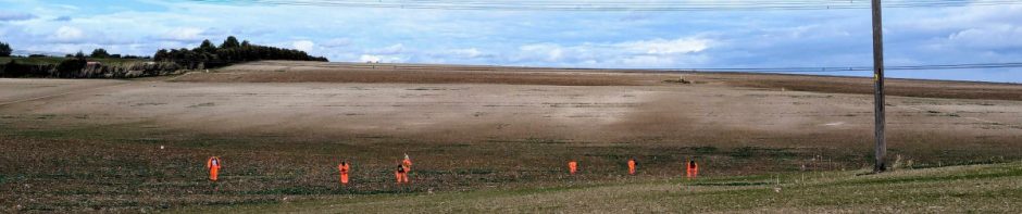
However by the time of Henry’s death in 1339, his son John, 2nd baron Cobham, had returned to Kent and was summoned to Parliament in 1326, 1329 and 1334. He became a prominent office-holder17 and was Admiral of the King’s Fleet in 1335 as well as Constable of Rochester castle. He was summoned to Parliament in 1350 and 1355 and died in the latter year18. It is around the 2nd baron’s time that excavations in the east courtyard at Cobham Hall by Alan Ward and others in 2005-2008 first provide a link between the history and the physical remains of the manor. Ward’s Phase 1 was a gravel surface, probably a courtyard, implying earlier unseen medieval buildings, possibly of timber, for which he suggested a 14th century date.
3rd Baron
John’s son the 3rd baron was another John de Cobham. In the reign of Edward III, John served in France and he did diplomatic service under Edward and then Richard II. As a judge, John was a trier of petitions and from 1386 was a commissioner reviewing charges against several of the king’s friends19. Locally, John was known as the “Founder”; he was the builder of Cobham College in 1362, of Cooling Castle in 1381 and of Rochester Bridge (with Sir Robert Knolles) in 1383. However in 1397 John retired to a monastery following the death of his wife. Even so, he was soon arrested by the Duke of Lancaster and imprisoned in the Tower of London for his part in exiling the Earl of Suffolk, who had been a friend of the king. John was declared a traitor, his estates were confiscated and he received a sentence of death, later reduced to banishment to Jersey. His son-in-law Sir Reginald Braybrooke was allowed to rent his “castle and manor of Coulynge, the hundred of Scamelle and the site of the manor of Cobham”20.
When in 1399, Henry Duke of Lancaster supplanted Richard II, John de Cobham was released and his estates returned to him, the close roll repeating the phrase, “the site of the manor of Cobham”21. Either Henry de Cobham’s early 13th century manor house was now ruinous or it had been demolished. This does seem to rule out the theory maintained by some writers that Cobham College occupied the site of the old manor house of Cobham. Cobham manor was clearly still a “site” 30 years or more after the College had been built. But what had happened to the manor house? Given the 3rd baron’s enthusiasm for building, allowing his principal house to fall into decay seems unlikely. It is possible that having rebuilt Cooling John had no need of Cobham, but it seems more likely that he demolished the 200 year old house because he intended to rebuild it. This situation is perhaps reflected in Alan Ward’s Phase 2, which comprised just boundary or garden walls, not using brick, on the east side of what is now East Court, possibly related to an unseen building under the present West Court. Ward suggests a late 14th or early 15th century date, which would put it in the days of the 3rd baron, who died in 1408. But after returning from exile in Jersey and having to reclaim his estates, John de Cobham must have lost his appetite for rebuilding, for he retreated into a monastery in Wiltshire for the remainder of his life.
4th and 5th Baroness
The male line of the Cobhams failed after John the 3rd baron. His daughter Joan de Cobham married John de la Pole of Chrishall in Essex c.1370 but she died in her father’s lifetime. The barony was continued by her daughter Joan, 4th baroness Cobham, who was to marry five husbands and seems to have lived in the newly rebuilt castle at Cooling and run the Cobham estates from there. By her second husband, Sir Reginald Braybrooke, Joan bore a daughter, the third Joan, who would eventually succeed her. Her fourth husband, Sir John Oldcastle, was a friend of Henry V and a respected soldier, but later he became notorious as a Lollard and was eventually captured at Cooling. He was taken to the Tower of London but escaped, then was recaptured and executed in 1417. Joan married again and lived quietly at Cooling, dying in 1434 four years before her last husband. 22
Joan Braybrooke 5th baroness Cobham was the daughter of Joan the 4th baroness. She married Sir Thomas Brooke of Holditch Court in Dorset and they lived there until his death in 1439 and hers in 1442. Sir Thomas held various local offices in Somerset and Devon though he found it hard to escape accusations of Lollardry, even in the west country.23
6th and 7th Baron
Their son, Edward Brooke, 6th baron Cobham was MP for Somerset in 1439 and 1442 and a Yorkist. He was summoned to Parliament from 1445 to 146324 and he eventually moved back to Kent after an attack on his home at Holditch in Somerset by the Lancastrian Earl of Ormond in 144925. Edward fought in the battles of St Albans in 1455 and Northampton in 1460 and he died at Cobham or Cooling in 1464. Ward’s Phase 3 comprised building foundations, again without brick material, in the south west corner of what is now the East Court, on a different alignment from Phase 2. On the east side of the Court only floor deposits survived, of possible unseen timber buildings of similar date, all these being before 1450. These were presumably works carried out by or for Edward Brooke on his return to Kent.
John Brooke the 7th baron, son of Edward, was born at Cooling c.1447. His children were mostly baptised at Cobham so he may have lived there, though he and his descendants continued to hold Cooling in Kent and also Holditch and Weycroft in Devon until the attainder of the 11th baron Cobham in 1605. He was summoned to Parliament in 1472 and regularly thereafter. He was said to have been in high favour with Edward IV and Richard III26. John was on the expedition to Flanders with Henry VII in 1491-92 and he fought against the Cornish at Blackheath in the insurrection of 1497 with his father-in-law Lord Abergavenny27. John Brooke seems not to have held local office and he was never a justice or sheriff of Kent28. He died in 1512. It appears to have been John the 7th baron who proceeded with the major rebuilding at Cobham for which John “the Founder” had been preparing back in the 14th century, though it is possible that a start on this work was made in the 6th baron’s time. Alan Ward’s Phase 4 comprised massive foundations of a large building mostly on the east side of the East Court, which he dated to after 1450. The walls extended under the present-day standing ranges but were on a different alignment. Some of the foundations contained a few brick fragments. There was possibly a tower at the south end of the building. Ward’s Phase 5 may be a continuation of Phase 4. It consisted of brick foundations which he dated to 1475-c.1500, in the south west corner of East Court, possibly linking with walls further east. Again, the walls extended under the standing ranges but on a different alignment.
8th baron
Thomas Brooke, 8th Baron Cobham was born c1465 at Cooling, probably too late to have been involved with Phase 5 at Cobham Hall. All his children were born at Cooling. He does not seem to have held any local offices in Kent29 until 1525 when he was appointed Commissioner to collect taxes in Kent for Henry VIII and became very unpopular as a result. Thomas, like his father, was a soldier and courtier for most of his life. He fought in the seige of Tournay in 1513 and at the Battle of the Spurs the same year and the following years was invested as a Knight Banneret. In 1520 Thomas Brooke was at the Field of the Cloth of Gold and in 1521 he was one of the twelve barons for the trial of the Duke of Buckingham32. He died in 1529 at Cobham and his will contains the first known reference to the manor of Cobham Hall33.
It is not clear whether Thomas Brooke was responsible for Alan Ward’s Phase 6, the brick built standing ranges on the north and east sides of what is now East Court. We have a problem here, for although Ward believes that the Phase 4 and 5 buildings in the East Court were all demolished by the mid 16th century, Phase 6 appears to have started well before that. The diaper brickwork on the south-facing wall of the standing range north of East Court is quite unusual and probably early. It has 13 horizontal zigzag lines of diaper-work (the topmost partly destroyed by a parapet). They do not touch and they do not form the customary lozenge or lattice patterns.34 The only other example of this I can find is on the west wall of the gatehouse of Hadleigh Rectory, Suffolk, built by Archdeacon William Pykenham who died in 1497.35 Mr Avray Tipping terms this feature waving. Another wall at Hadleigh has diapering arranged to form one huge diamond, which is another feature we have at Cobham on the north face of the NE corner tower36. Even if we stretch the date of the work at Cobham forward to 1520-30 as proposed by Roger Bowdler37, we are bringing the building of Phases 4 and 5 in the late 15th century uncomfortably close to their demolition and probable replacement by Phase 6 early in the 16th. So perhaps all these phases of buildings might have existed at the same time, or perhaps Alan Ward’s conclusions on his Phases 4 and 5 were mistaken, or perhaps Mr Bowdler and myself are dating Phase 6 and its diaper bricks too early. Clearly the “1520s” brick-built standing ranges could be the work of either the 8th or the 9th barons. Whoever built them, these ranges would set the future alignment of the massive 16th and 17th century buildings for which Cobham is known today. They need closer examination.
9th Baron
George Brooke, 9th baron Cobham was born c.1497 at Cooling and was the son of Thomas, the 8th baron. Much of his early life was spent on military service. He went to Ireland in 1520; he served with the fleet in 1522, and he was in the attack on Calais of 1522-23. George was made Baron Cobham in 1529 and in 1536 was one of 27 peers appointed to try Anne Boleyn. He acted as a courtier from 1537 to 1544.38 A letter from the Privy Council of December 1543 asks the Archbishop of Canterbury to entertain the Viceroy of Naples as “in consequence of a fire having taken place in his house, he (George Brooke) would not be able fitly” to undertake that task.39 It is not possible to tell if the fire affected the Phase 4/5 buildings or perhaps delayed the extension of the “1520s” ranges. Meanwhile, George was made Lieut.General of the army against the Scots, but was recalled for an invasion of France and made Deputy of Calais. He was still at Calais in 1546, but in 1548 he was made Knight of the Garter and went on embassy to the French king at Amiens. On his return George was made Privy Counsellor and was greatly in the favour of Henry VIII. Under Edward VI, he served on a committee to examine the Duke of Somerset.40
All began to go wrong for the Brooke family when Roman Catholicism was, for a time, restored under Queen Mary. Sir Thomas Wyatt began his rebellion against the Royal marriage at Maidstone early in 1554, and he assumed the Brookes, who were his relatives, would join him. George Brooke was wise enough to stay loyal to the Queen though two of his sons joined Wyatt. Like John Oldcastle a century before, he must have been thankful to be able to retire his castle of Cooling.41 However it did him little good and he was obliged to surrender to Wyatt. All were duly arrested and Wyatt was executed next month. The Brookes were released, some sooner and one later. George Brooke died in 1558 at Cobham Hall.
10th Baron
William Brooke, 10th baron Cobham had done military service in 1549 in the attempted recovery of Boulogne, but that seems to have been an end of it. He was an esquire to Edward VI and was knighted shortly before his father’s death. His involvement with Wyatt’s rebellion did not turn Queen Mary against him and he was made Lord Warden of the Cinque Ports and Constable of Dover Castle. Queen Elizabeth confirmed him in these offices and others in the county. William was sent on an embassy to King Philip of Spain (whom Queen Mary had married) to announce Mary’s death and Elizabeth’s accession, though his political negotiations with Spain and France were unsuccessful.42 Queen Elizabeth visited him at Cobham Hall in July 1559 and Holinshed recalled many years later that “this lord did most honorablie interteine the queene with hir traine, at his house of Cobham hall with sumptuous fare, and manie delights of rare invention. Amongst which… was: a banketing house made for hir maiestie in Cobham parke, with a goodlie gallerie thereunto, composed all of greene, with several devises of knotted flowers, supported on each side with a faire row of hawthorne trees, which nature seemed to have planted there of purpose in summer time to welcome hir maiestie, and to honor their lord and maister.” 43
Queen Elizabeth proved a good friend to William Brooke and to his second wife, Frances Newton, who had been a lady of her bedchamber. He had some involvement in the Duke of Norfolk’s conspiracy in 1572 but despite the Duke’s execution, William was exonerated. In 1573 he entertained the Queen again at Cobham Hall for 2 days. He was sent, with Sir Francis Walsingham in 1578 to Don John of Austria, the governor of the Netherlands to negotiate terms for the States, but they were unsuccessful.43 In 1582 he began work on “the statelie augmenting of his house at Cobham hall, with the rare garden there, in which no varietie of strange flowers and trees doo want, which praise or price maie obteine from the furthest part of Europe, or from other strange countries, wherby it is not inferior to the garden of Semiramis”.44 William Brooke went on to complete the present south and north standing ranges which enclose the West Court. Most histories of Cobham Hall begin at about this point and readers may now wish to continue with the studies by Wingfield-Stratford, McKeen, Tatton-Brown and Bowdler.
(Roger A. C. Cockett, October 2016)
Footnotes
1: The “olde buildinge” of 1601:
Several writers relate a line from a letter to Henry Brooke from his steward in 160145: “a dore to be made at the hed of the staier into the olde buildinge”, which they usually assume refers to an earlier east range standing approximately where the Gilt Hall is now. A door does exist at the head of the great staircase in the 1594 north range, but now it leads east into James Wyatt’s upper gallery. However a watercolour plan of c.1789 by the engineer Samuel Lapidge46 shows that before the advent of Wyatt, the 1520s north range extended right up to the end of the 1594 range and that is where the door would have led to. If this was not what the steward meant, we must assume that parts of Ward’s Phase 4 or 5 structures still survived where the Gilt Hall is now and that they comprised the “olde buildinge”. In any case, the Dukes of Richmond & Lennox doubtless intended to replace these buildings, which would have been out of alignment and probably character, with the 16th century work. Maybe by 1641 they had got as far as demolishing them, with the result shown on Thomas Norton’s map of that year47, where William Brooke’s north and south ranges stand isolated from each other.
2: A late structure in the East Court:
Lapidge’s plan of c.178946 also shows an intriguing little building in the NW corner of the East Court, having two rooms, each with a bay window facing east and a small staircase between them. No other map shows this building, particularly Peckham’s of the same year. Probably it was just a conjecture.
3: The Cobham Hall building periods to 1584 – dates approximate:
1165-1202 perhaps a farmhouse
1202-1396 first capital messuage – Ward’s Phase 1
1396-1450 mainly empty site – Ward’s Phases 2 & 3
1450-1525 large house with massive foundations – Ward’s Phases 4 & 5
1525-present brick ranges to N & E of the East Court – Ward’s Phase 6
1584-present brick ranges to N & S of theWest Court -Ward’s Phase 7
References
1 TNA Prob 11/23/361
2 KHLC U565 T001
3 Charter S.447. Kings College London website, accessed Aug 2016. http://www.esawyer.org.uk/searchfiles/index.html
4 Becker, 1930 pp.2-3.
5 Medway Archives, Textus Roffensis, DRc R1 folio 221 recto.
6 Dugdale, p.89.
7 Pipe Roll 1164, Kent.
8 Boteuile.
9 Boteuile recites the grant [n.d.].
10 Saul, p.13.
11 Hart, p.18 (from Charter Roll 15th May 1208 – Record Commissioners).
11a Hall, p.751.
12 Nichols, p.320: Charters from the Muniment Room at Cobham Hall recorded by Robert Glover in 1574.
13 Scott-Robertson, W.W.. 1877. In Archaeologia Cantiana vol.XI p.128.
14 Saul, p.14.
15 Becker, 1930 p.26.
16 Saul, p.19.
17 Saul, p.19.
18 Saul p.20.
19 Saul, p.21.
20 Curran p.103 & Calendar of Patent Rolls December 1398.
21 Calendar of Close Rolls, 1 Hen IV, 20th Nov 1399 p.59.
22 Curran pp.18-20 & p.107.
23 Waller, J.G., 1877. In Archaeologia Cantiana XI, p.101.
24 Waller, J.G., 1877. In Archaeologia Cantiana XI, p.101.
25 Ede, Holdiche Court and Waller, J.G., 1877. In Archaeologia Cantiana XI, p.103.
26 Waller, J.G., 1877. In Archaeologia Cantiana XI, p.104.
27 Waller, J.G., 1877. In Archaeologia Cantiana XI, p.104.
28 Kilburne, pp.394-396 & Harris pp.427-432.
29 Kilburne, pp.394-396 & Harris pp.427-432.
32 Waller, J.G., 1877. In Archaeologia Cantiana XI, p.109.
33 TNA PCC Wills, Prob/11/23/361 Sir Thomas Broke, 7th July 1529.
34 Personal observation.
35 Avray-Tipping pp.343-346.
36 Personal observation.
37 Cobham Ashenbank Mangement Scheme, Report vol.1 p.31 & vol.2, p.82.
38 Waller. J.G. 1878. In Archaeologia Cantiana XII, p.113.
39 Waller. J.G. 1878. In Archaeologia Cantiana XII, p.114.
40 Waller. J.G. 1878. In Archaeologia Cantiana XII, p.116.
41 Waller. J.G. 1878. In Archaeologia Cantiana XII, p.120.
42 Waller. J.G. 1878. In Archaeologia Cantiana XII, p145.
43 Waller. J.G. and Thynne, 1878. In Archaeologia Cantiana XII, p.146.
44 Waller. J.G. and Thynne, 1878. In Archaeologia Cantiana XII, p.146.
45 Wingfield-Stratford p.75 letter from one Williams, Steward to Lord Henry Brooke, listing work still in progress. From TNA Domestic State Papers.
46 Bowdler Section 2.6 Illustrations 11.
47 Medway Archives U565 P1.
Bibliography
Avray-Tipping, H., 1937. English homes, Medieval and Early Tudor.
Becker, M. J., 1930. Rochester Bridge 1387-1856: a history of its early years.
Bowdler, R., (2002, unpublished). Historical account Cobham Hall Estate: part II.
Dugdale, Sir Wm, 1846. Monasticon Anglicanum.
Ede, J., 1982 (unpublished). Thorncombe: a village history.
Hall, H., 1896. Red book of the Exchequer: part II.
Hart, W. H., 1878. Records of Gravesend, Milton, Denton, Chalk, Northfleet, Southfleet and Ifield: Part I.
Harris, J., 1719. History of Kent.
Nichols, J. B., 1841. Collectanae topographica and genealogica: vol VII.
Boteuile, F., 1586. A Treatise of the Lord Cobhams.
Kilburne, R. 1659. A survey of the County of Kent.
McKeen. D. (n.d.). A Memory of Honour.
Saul, N, 2001. Death, art and memory in Medieval England.
Wingfield-Stratford, E., 1959. The Lords of Cobham Hall.